
This research combines bio-inspired robotics and reinforcement learning to develop adaptable amphibious robots modeled after sea turtles. By learning through trial and error across diverse terrains, these robots can adjust their movement strategies in real time, improving performance in applications such as environmental monitoring, search and rescue, and agriculture.

2026
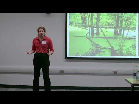
This research uses freshwater mussels as bioindicators to investigate water quality in Darby Creek. Community science data revealed links between elevated chloride pollution, likely from road salt, and declining mussel populations. The discovery of a healthy mussel population highlights both the importance of local monitoring and opportunities for targeted watershed restoration.
2026
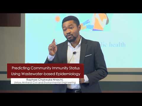
This research uses wastewater-based epidemiology to monitor antibodies excreted by communities, providing early insights into population vulnerability to infectious diseases. By analyzing antibody trends in wastewater over time, the work helps public health authorities identify at-risk communities, allocate resources more effectively, strengthen vaccination strategies, and improve outbreak preparedness.

2026
This research investigates phosphorus pollution in Lake Warner by comparing water movement and phosphorus transport through urban and forested landscapes. Forests naturally filter phosphorus due to slower water travel and greater infiltration, while urban runoff accelerates pollution. The study identifies how interventions such as rain gardens can reduce phosphorus loading into lakes.
2026
Road salt, widely used for winter safety, contaminates waterways and drinking supplies by increasing sodium and chloride levels. This year-long study of Pennsylvania watersheds found consistent exceedances of EPA guidelines, posing risks to human health and aquatic ecosystems. The research highlights the need to reduce salt use and adopt more sustainable deicing practices.
2026
This research uses low-cost air quality sensors to monitor pollution exposure in underserved communities in Philadelphia. It reveals unexpected indoor and temporal pollution patterns and highlights disparities in exposure. By involving residents as citizen scientists, the study demonstrates how accessible data can inform policy and improve public health outcomes.

This research examines how hydropeaking dams cause fish stranding due to rapid flow changes. Using camera monitoring and modeling, it identifies environmental factors like substrate type and seasonal fish abundance that increase risk. The work highlights the need to balance renewable energy production with ecological sustainability in freshwater systems.
This research investigates methane emissions from restored marshes as a climate solution. While marshes sequester CO₂, their methane output varies widely. By measuring emissions and environmental factors, the study examines how interactions influence outcomes, highlighting that restoration can aid climate mitigation but requires deeper understanding to ensure effectiveness.
2026
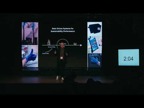
This research develops data-driven systems to help organizations measure and reduce their environmental impact. Using low-cost sensors and digital tracking tools, the work enables companies and hospitals to better understand emissions and resource use. Case studies show significant reductions in carbon emissions and disposable glove usage through practical design science solutions.
This study examines whether burned area from forest fires in Portugal can be predicted using satellite, weather, and time-series data. Results show human-caused fires dominate over natural ones, and predictive models achieved around 95% accuracy, demonstrating strong potential for improving resource allocation and fire management strategies.