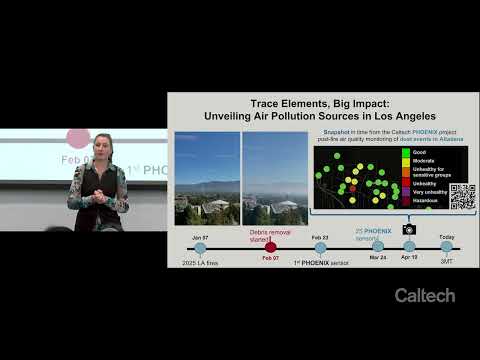
This research investigates atmospheric trace elements as indicators of pollution sources, focusing on toxic metal emissions from urban firestorms during the Eaton Canyon and Palisades fires. Elevated airborne lead concentrations prompted the creation of Phoenix, a community-based post-fire air monitoring network designed to track hazardous dust resuspension during debris cleanup.
This study evaluated multispectral and hyperspectral vegetation indices to estimate wildfire severity in the 2022 Sierra de la Culebra fire. Field Composite Burn Index data were correlated with satellite-derived indices. Results showed hyperspectral imagery provided more accurate severity estimates, particularly using Cellulose Absorption Index and Red Edge indices.
This project uses prescribed grazing to manage invasive vegetation and reduce wildfire risk in California. Grazing mimics natural disturbances, lowers hazardous fuels, improves soil health, and supports native biodiversity. The LandSmart Grazing Program funds landowners, builds infrastructure, educates communities, and strengthens local economies through sustainable, landscape-scale vegetation management.